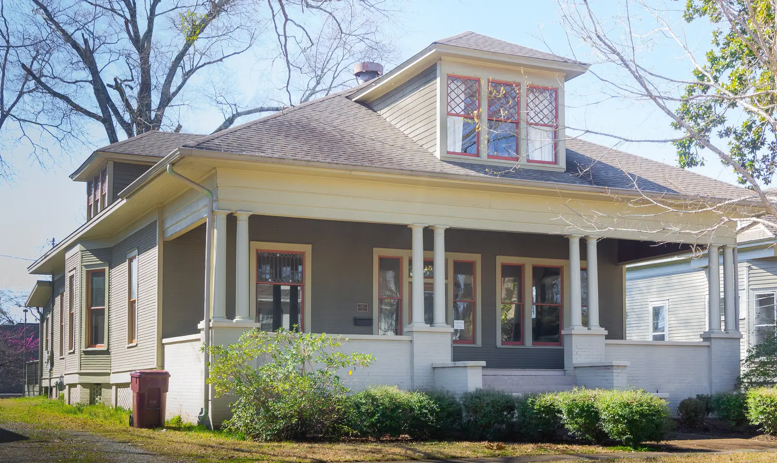
Eight Tupelo neighborhoods named in the city's own code and maps, with ZIP codes, elementary school zones and September 2026 Zillow home values for each.
Last checked Oct. 16, 2026. Sources: the City of Tupelo’s development code overlay districts (PDF), historic preservation guidelines (PDF) and overlay and historic district map, the Tupelo Public School District’s K-5 attendance zone map (PDF), the Mississippi Department of Education’s Mississippi Succeeds Report Card, Zillow Research, the Census Bureau and OpenStreetMap.
Tupelo is a city of 37,825 people in Lee County, according to the Census Bureau’s 2019-2023 American Community Survey five-year estimates. U.S. 45 runs north and south along the east side of downtown, and I-22, which shares its route with U.S. 78, crosses the north side of the city. City Hall is at Fairpark, 71 E. Troy St., downtown.
The neighborhoods with names on the city’s own maps are the older ones close to downtown. The city’s development code gives several of them overlay districts, each with its own design review committee, and three are historic districts. Most newer subdivisions farther out have no city-recognized neighborhood name, so this guide does not cover them.
Three things to know before you look at a listing:
- City limits are not the mailing address. A “Tupelo” address can be outside the city and outside the Tupelo Public School District. The schools guide explains the Lee County School District, which serves most of the county outside the city.
- Two ZIP codes cover most of the city. Every neighborhood in this guide is in 38804 except Winfield, which is in 38801, by the Census Bureau’s ZIP code areas.
- Only elementary school zones vary. The district has one sixth-grade school (Milam Elementary), one middle school (Tupelo Middle, grades 7 and 8) and one high school (Tupelo High), according to the federal NCES school directory. Kindergarten through fifth grade is split into four zones, each with a lower and an upper elementary school. The zone map is a picture, not an address lookup, so confirm any address with Student Support Services, 662-841-8955.
The neighborhoods at a glance
Home values are the Zillow Home Value Index for the whole ZIP code in September 2026: a modeled typical value for the middle third of homes, not a sale price. The Tupelo citywide figure was $216,061, up 5.6% in a year. Elementary zones are read from the district’s zone map.
| Neighborhood | ZIP | Elementary zone (lower / upper) | High school | Typical home value in its ZIP |
|---|---|---|---|---|
| Downtown | 38804 | Carver / Lawhon | Tupelo High | $204,377 |
| Historic Downtown Neighborhood | 38804 | Carver / Lawhon | Tupelo High | $204,377 |
| Highland Circle | 38804 | Carver / Lawhon | Tupelo High | $204,377 |
| Mill Village | 38804 | Carver / Lawhon | Tupelo High | $204,377 |
| Park Hill | 38804 | Carver / Lawhon | Tupelo High | $204,377 |
| Joyner | 38804 | Joyner / Rankin | Tupelo High | $204,377 |
| West Jackson | 38804 | Joyner / Rankin | Tupelo High | $204,377 |
| Winfield | 38801 | Thomas Street / Pierce Street | Tupelo High | $208,847 |
Map of the neighborhoods
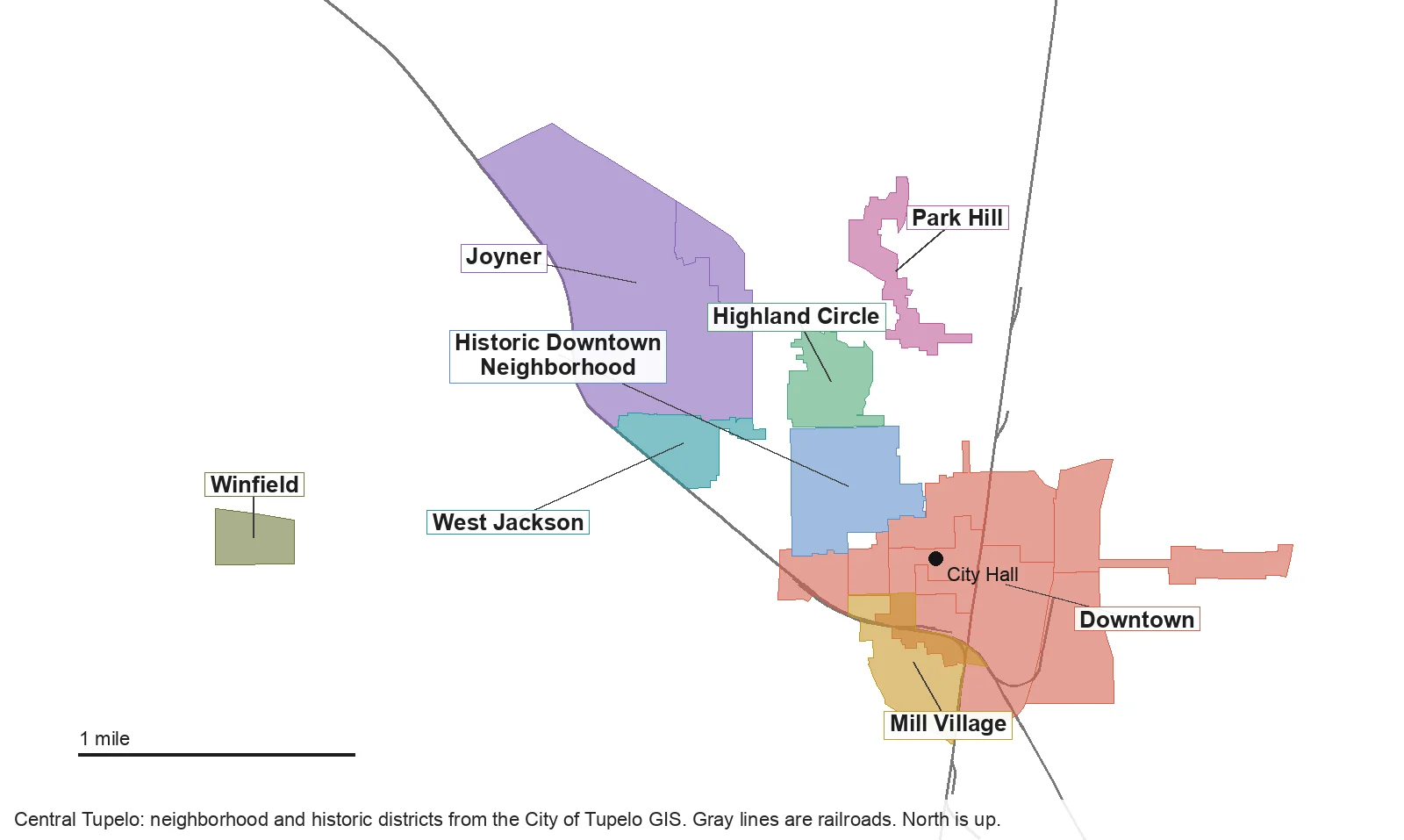
Map by Tupelo Now from the City of Tupelo’s GIS layers for overlay districts, historic districts, downtown sub-districts and railroads. Edges follow the city’s mapped boundaries.
Downtown and the blocks around it
Downtown. The city’s Mixed Use Downtown overlay, split into sub-districts that include Fairpark, where City Hall stands, the courthouse area and the Gateway East corridor toward the Elvis Presley Birthplace. Homes here are mostly upper-floor apartments and lofts, which the code encourages in the retail core.
Historic Downtown Neighborhood. The residential blocks between Main Street and East Jackson Street on the west side of downtown, with their own conservation overlay since 2018. New homes and exterior changes go to a neighborhood design review committee.
Highland Circle. A National Register historic district listed in 2006, on Highland Circle, North Madison Street and Oak Grove Road, just east of North Gloster Street.
Mill Village. The houses built for Tupelo Cotton Mills workers from about 1900, south of Main Street. It is the city’s certified local historic district, so exterior work needs a certificate from the Historic Preservation Commission.
Park Hill. North of downtown along North Green Street and Tolbert Street, near the McCullough Boulevard interchange with U.S. 45, with an overlay that aims to bring stores and services back to its business corridor.
West of Gloster Street
Joyner. The largest of the overlays, from McCullough Boulevard south to Woodlawn Street, with Rob Leake City Park and Joyner Elementary inside it. It includes the smaller Belledeer overlay on its east side.
West Jackson. Blocks along West Jackson Street and Chapman Drive just south of Joyner, where the code caps new houses at 2,000 square feet.
Winfield. A single subdivision-sized overlay on Winfield Drive, west of North Thomas Street, about 2.5 miles west of City Hall, where the code bars townhouses, accessory dwellings and lot splits.
What each overlay means for an owner
In an overlay district, a permit for new construction or exterior work goes to a design review committee before the city issues it. Most committees have three residents chosen by the neighborhood association, one member named by the mayor and one named by the ward’s council member, the code says. Mill Village uses the Historic Preservation Commission instead. Ask the city’s Planning Division, 662-841-6510, before you buy if you plan to build or remodel; our building permits and zoning guide explains the permit steps.
More for movers
For the citywide market, see our home prices guide; for every school, its calendar and its grade, our schools guide. Getting set up: moving to Tupelo, property taxes, parks and trails and getting around.
How we built this
We named only areas a public source places on a map. The sources were:
- The city’s development code, chapter 5, which creates the Mixed Use Downtown, Joyner, Park Hill, Mill Village, West Jackson, Winfield, Historic Downtown Neighborhood and Belledeer overlay districts, each with a boundary map.
- The city’s historic preservation guidelines (2007), which describe the Mill Village and Joyner historic districts, and the city’s GIS historic district layer, which lists Highland Circle, North Broadway and the Downtown Historic District as National Register districts.
- OpenStreetMap, which also names Highland Circle as a place.
- ZIP codes from the Census Bureau’s 2020 ZIP code areas, and elementary zones read from the Tupelo Public School District’s K-5 zone map, both checked against the city’s district boundaries.
OpenStreetMap also names dozens of individual subdivisions in and around Tupelo. We left them out because the city does not recognize them as neighborhoods. East Tupelo, where Elvis Presley was born, appears in the city’s history but has no mapped boundary in any city source, so it does not have its own page. Store and place data are © OpenStreetMap contributors.
Frequently asked questions
What are the neighborhoods in Tupelo?
This guide covers the eight areas the City of Tupelo names in its development code and maps: Downtown, the Historic Downtown Neighborhood, Highland Circle, Mill Village, Joyner, West Jackson, Park Hill and Winfield.
What ZIP codes are in Tupelo?
Tupelo addresses use 38801 and 38804, and the city also reaches into 38826, which Zillow files under Belden. Seven of the eight neighborhoods in this guide are in 38804; Winfield is in 38801.
Which high school is Tupelo zoned for?
The Tupelo Public School District has one high school, Tupelo High School, one middle school for grades 7 and 8 and one sixth-grade school, Milam Elementary, according to the federal school directory. Only the elementary schools are split into zones.
What is the typical home value in Tupelo?
$216,061 in September 2026, according to the Zillow Home Value Index, up 5.6% from a year earlier. ZIP code 38804 was $204,377 and 38801 was $208,847. The index is a modeled typical value, not a sale price.
Have your say